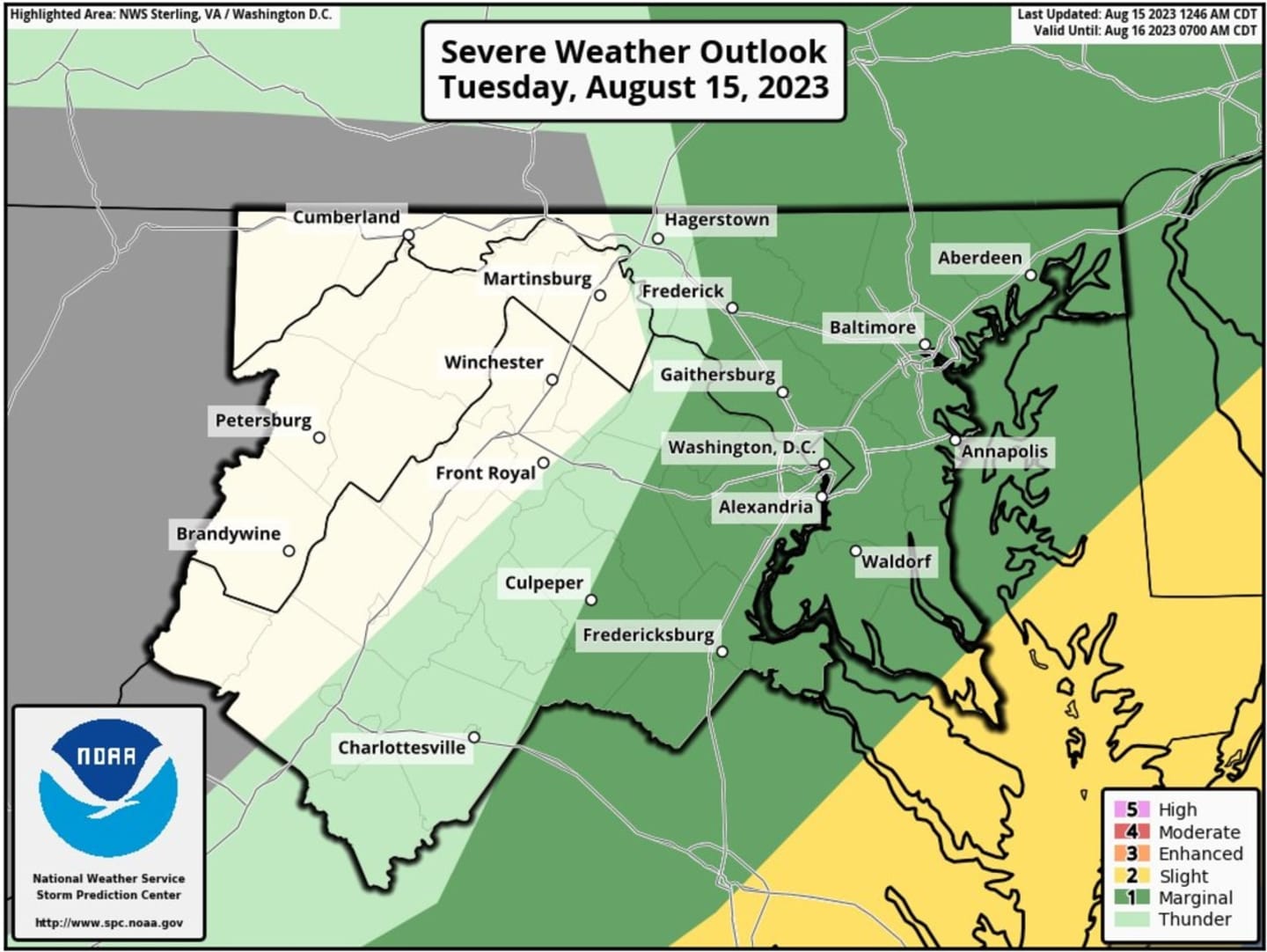
Forecasters say that there is a "Level 2" risk of severe weather on Tuesday, Aug. 15, which could bring isolated tornadoes, large hail, and potentially damaging winds, and flooding throughout the area.
The bulk of the bad weather is expected along the I-95 corridor and east, toward parts of Maryland, according to the National Weather Service.
A Flood Watch was also issued in parts of the area for the second straight day that will last through 8 p.m. on Tuesday, Aug. 15.
Despite rumblings, weather officials also made note that there is no tsunami heading toward the East Coast.
"Isolated to scattered severe thunderstorms are possible this afternoon into the early evening along and east of the I-95 corridor," according to forecasters. "Damaging wind gusts are the most likely hazard, although isolated large hail or a brief tornado are also possible."
According to AccuWeather, upwards of a half inch of rain could accumulate during the storms, though wind gusts are expected to be more manageable than recent storms.
Things are expected to dry up after Tuesday's storms, with temperatures hovering below 90 degrees throughout the region and partly cloudy skies.
Want breaking news in the DMV as it happens, or want to contribute? Join the DMV All Incidents Facebook group.
Click here to follow Daily Voice Cecil and receive free news updates.